“Differentiating between real fires and random ‘noise’ in the environment was a challenge,” Chris says. “We had to determine where to draw the line between what is a real fire versus things like sensor issues or misaligned pixels.” Developing a practical scientific solution required massive amounts of testing and refining; they even loaded a plane with sensors to experiment with their progress. “The first time we used the plane, one of our team members lit a barbeque and a firepit in his backyard so we could fly the plane over and test it,” says Erica Brand, one of the project managers for FireSat. “And the sensors were able to pick it up.”
Readying for launch — and the future
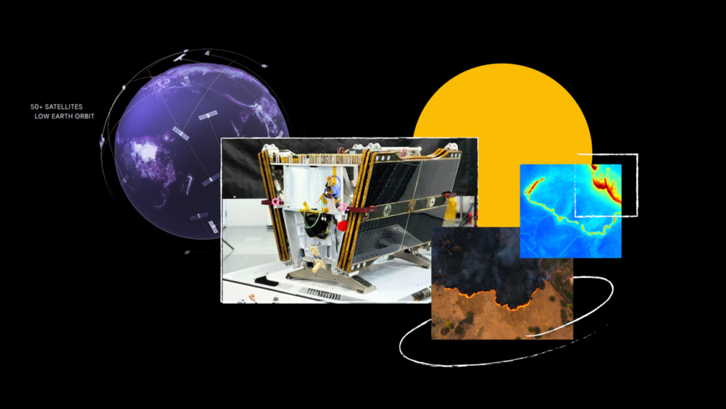
At the time of these interviews, the first FireSat satellite had just arrived at the SpaceX launch site.
And just yesterday, members of the Google Research team watched as the rocket — and the satellite — hit the skies. “Since launch dates move a lot, rather than book a flight we figured we’d just all meet and drive,” Erica says. “We called it ‘the minivan caravan plan.” While thrilled to see their efforts take flight, they’re more eager to see how firefighters and emergency responders use FireSat to react more quickly and effectively.
And big picture, FireSat will help advance the basic science of wildfires. The satellite data will contribute to a global historical record of fire spread so scientists can better model and understand wildfire behavior. “FireSat is more than just an emergency response tool,” says Juliet. “It’s also an incredible tool for reducing greenhouse gas emissions. It’s actually really beautiful that the constellation contributes to reducing climate change — while also responding to it.”